the hobo traveler
Capturing the State Parks of Texas
Come along as I visit and photograph a different park each month. I’ll share what I learn while there and offer insights into what makes each of them a special part of the Texas landscape.
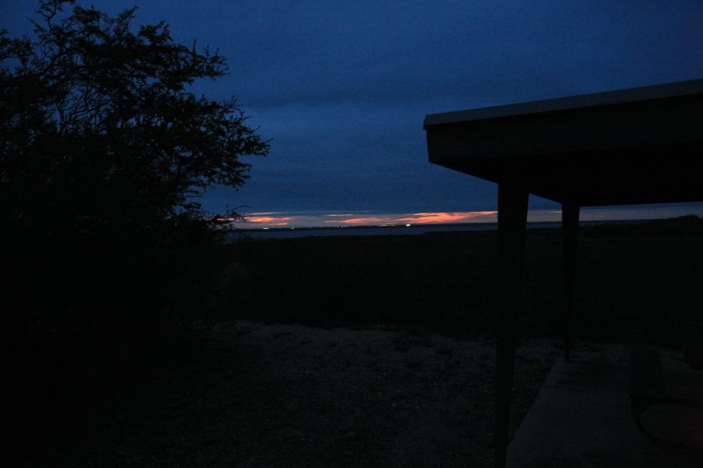
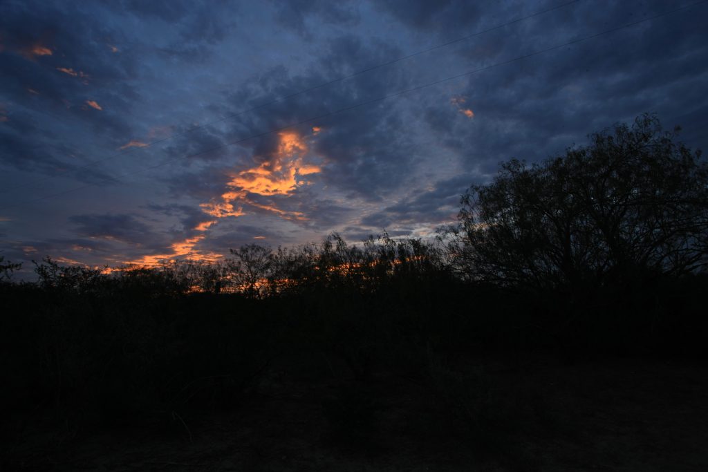
Located on the South Texas border with Mexico, Falcon International Reservoir is home to Falcon State Park, a brush country oasis for wildlife well adapted and suited to the environment. Mild winters welcome travelers with temperatures in the 70’s being common, making it a popular destination for those seeking to escape the harsher northern climates. Unfortunately, on my three-day stay, the temps would hover in the 50’s. Cold and humid, it reminded me more of East Texas this time of year than deep South Texas. Occasionally, when the sun would peek out, the mood of the whole area and mine would change. Below is a sunset picture off the Verdin Trail the last night I was there. The lights in the background are in Mexico. I scared up five or so deer, but I wasn’t able to get a picture of them.
The Trails
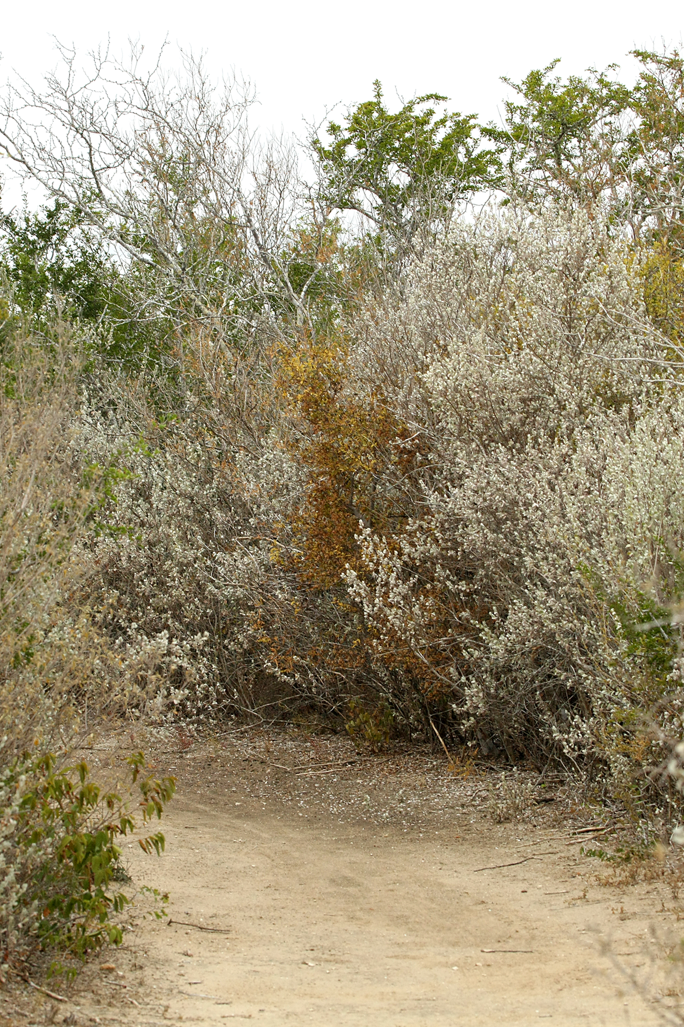
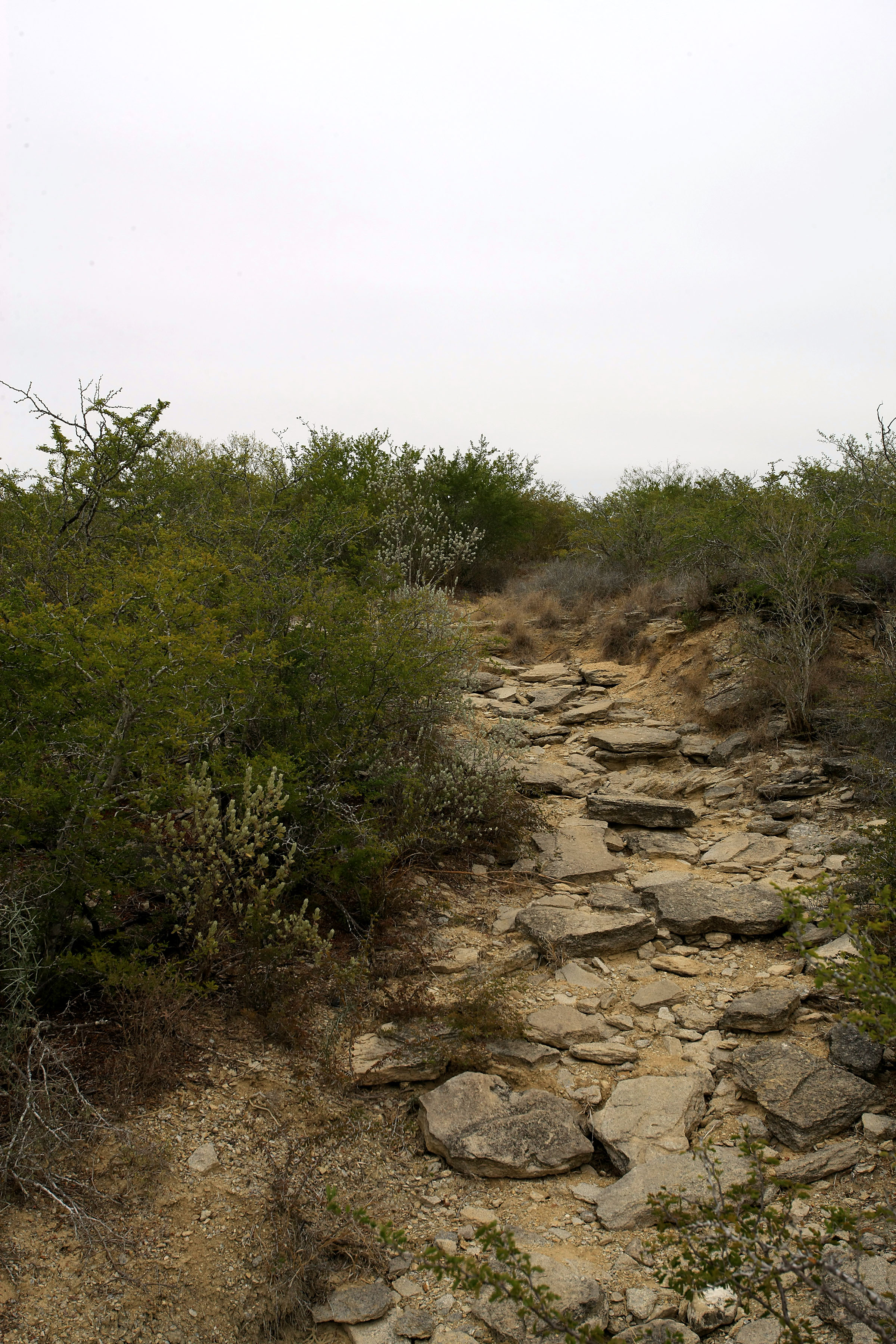
Falcon State Park offers almost three miles of trails, and they are named Whitebrush, Desert, Verdin and Roadrunner. Although unmarked on the map, benches nestled along the way offer hikers a welcome respite. The trails are mostly flat, smooth and easy walking. The rocks in the last photo below are on the Whitebrush Trail, a short walk from the park entrance. They are the only large rocks I encountered on the park’s paths and offered a unique experience with the included drop in elevation.


The Wildlife
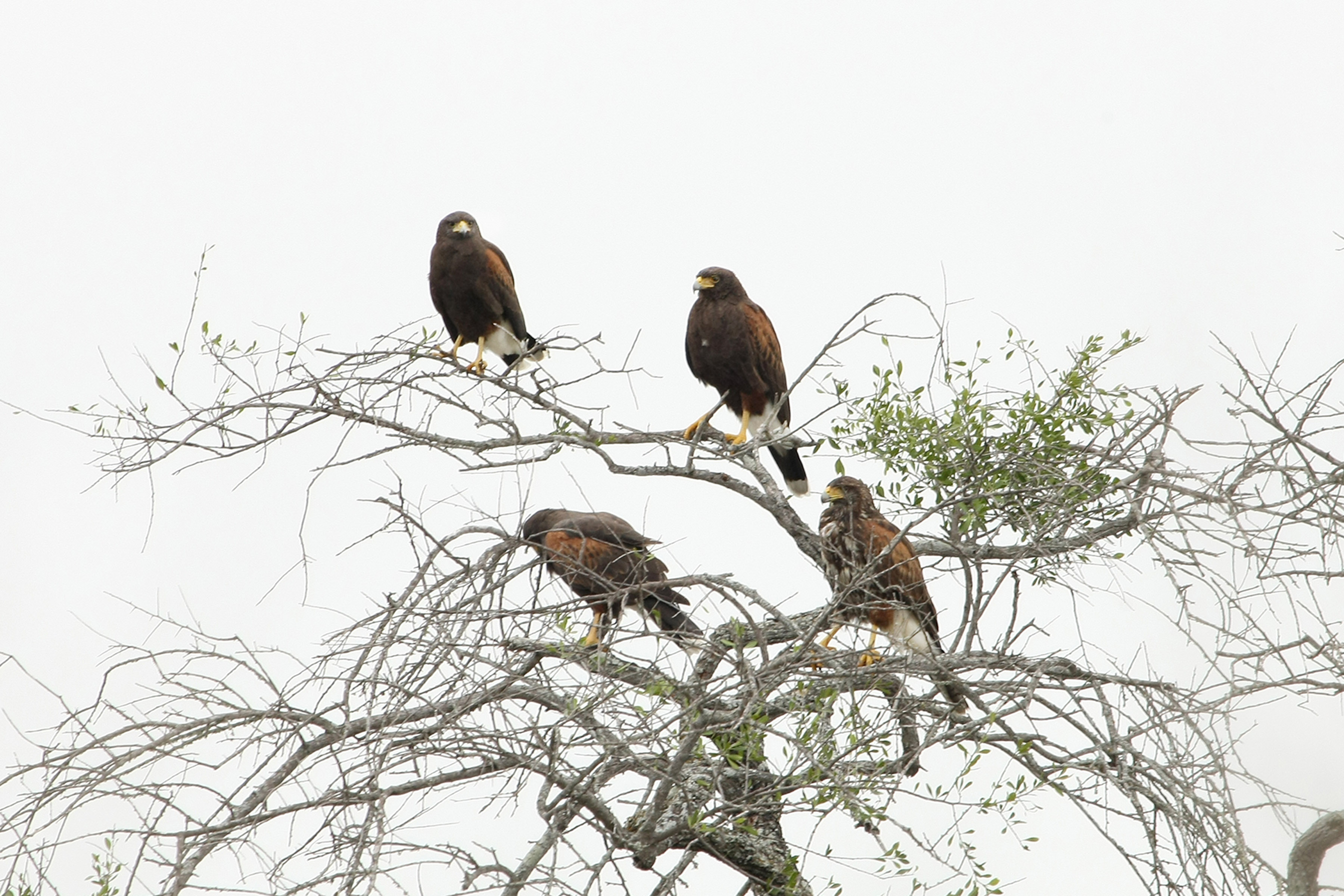
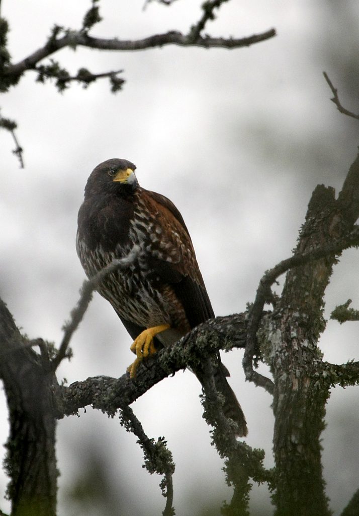
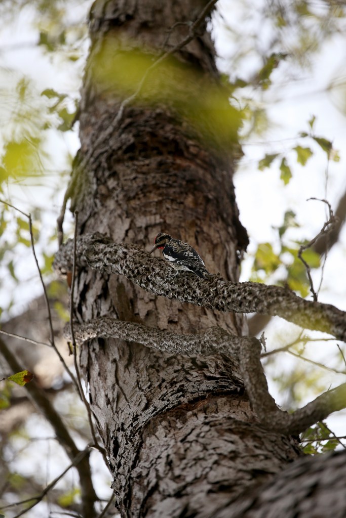
The park is home to a variety of animals. During my stay, I encountered roadrunners, hawks, javelinas, deer, coyote, many birds including green jays (Birds of Falcon State Park), and something that crossed the road in front of me during the foggy daylight morning. Gone in the brush before I could determine what it was, my first thought was some sort of large cat. At almost the same time I saw a doe and yearling in front of me and then a hawk in my periphereal vision that was in a tree very close to the road and right off of the Verdin Trail. I backtracked, picked up the camera and took the shot through the open passenger window. Later, while hiking the Verdin Trail, I came across the whole family. Harris’s hawks. How cool. You can read about them here.
As I moved along the trail, the area became open under the trees. At various spots were depressions that appeared to have held water and mud. Pig wallows I assumed. So I stopped, set up my camera on the tripod and waited. It was then that I realized I had lost my cap. Because of the beanie on my head, I hadn’t noticed when it fell off, so I loaded up the gear and back tracked. About a half mile later, I found it at the edge of the trail. As I stopped, I heard a distinctive chirping in the area trees and saw a bird hanging upside down eating something. Hoping for a shot, I quietly moved into position. Then I heard the blow, and I instantly knew I was being watched by a deer somewhere close. I slowly turned, and there she was. I only had time for one shot, and that’s the one you see here.

Later, while hiking the Woodlands trail, I heard a racket close by in the small trees. I moved closer and came upon four green jays making a commotion. I’ve taken green jay photos before, but that was at a feeder, and the set up was a lot more accomodating to the camera as I was semi-hidden in a park built blind with seating and rests. On this day, I was hand holding a 400mm lens on the trail, and the jays definitely knew I was there. They acted upset like jays do and were constantly moving around in the trees, staying close but never settling down. I took several shots to no avail. Finally, one sat still enough to suspiciously eye me for a bit. That’s the one you see below.

Finally, I called it a day, headed back to the truck and back to camp. I had hiked about eight miles that day and was tired. So I sat down at the little picnic table and rested the camera there beside me. Daylight was quickly fading when I heard some movement in the nearby brush. Not loud but not quiet either, it seemed to move with purpose. And then, all of a sudden, there stood a javelina. It was in no hurry and quietly went about its business allowing me to get some shots. It was close enough to hear the shutter on the camera and would jerk its right back leg every time I pressed the shutter release button. The picture below is of that javelina.

The Landscape
I live in South Texas, so I’m somewhat familiar with the terrain. However, because I live on the coastal side of Texas, I really didn’t know what to expect on the other side of the state. Upon arrival, however, I felt comfortable in the space. Like home in coastal Texas, this is a rough country. Veer off of the trails a bit, and it will quickly let you know that you are not in charge. Yet, to me, it was beautiful. Rugged and beautiful.
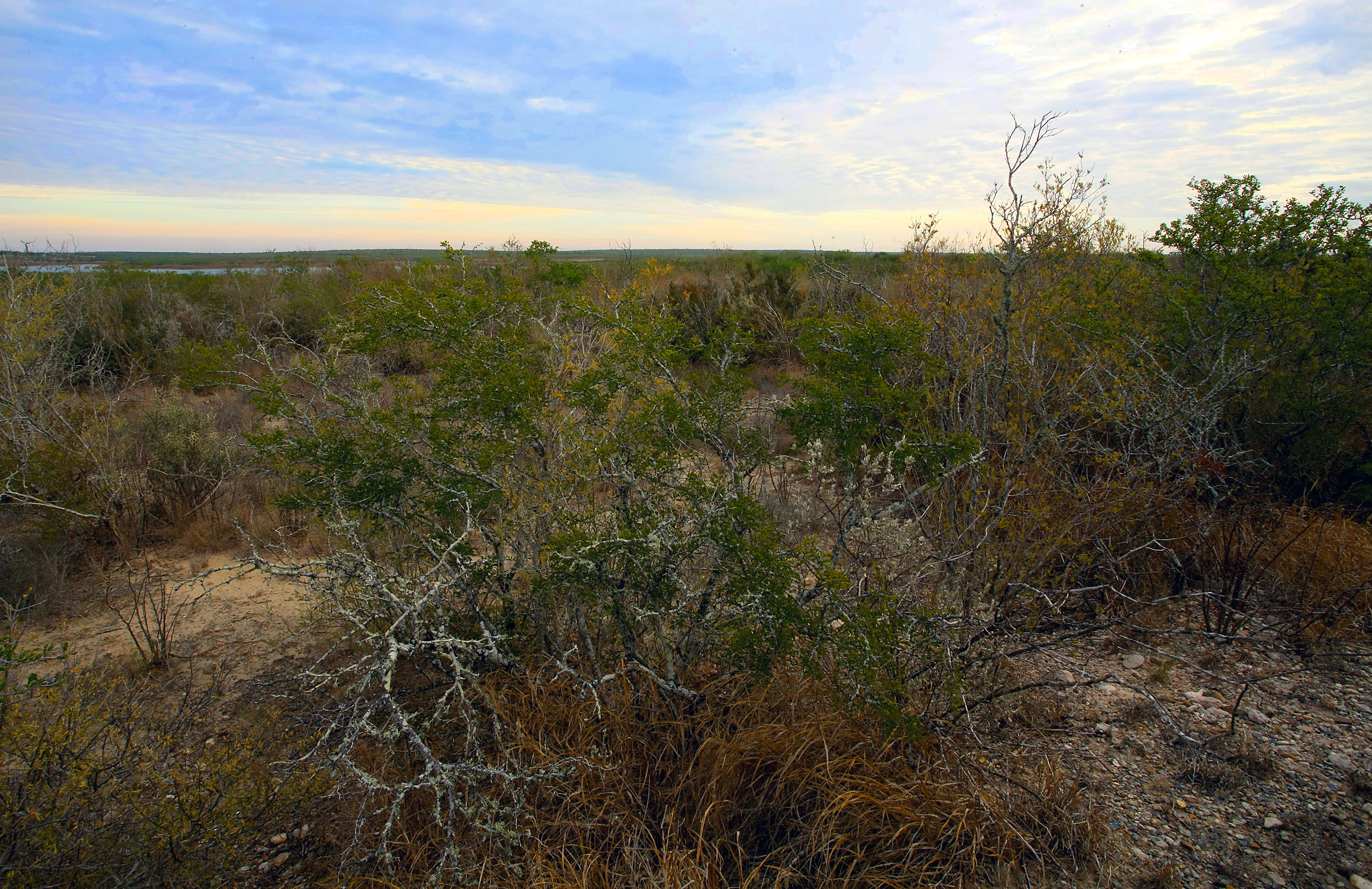
From several locations in the park, you can see expansive views of the countryside, the lake, and on to the other side, which is Mexico. One of those spots contains several tables and canopies that make up a hidden picnic area that I came upon while hiking the Verdin Trail. The water is very low at this lake, so I’m sure that much of the greenery you see in these pictures is normally covered by water. As I stood there, I quietly pondered how far the water level came up to the picnic area. Were you able to pull your boats up close?

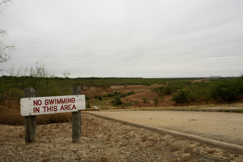
At the boat ramp, no water was present in stark contrast to what would be normal, as somewhat humorously evidenced by the No Swimming sign in the picture below. In the distance, you can see the dam. And down below is a small loading peir that people used for loading and unloading their boats. All of that is dry now.

My Stay
Because it was the beginning of December and not knowing what to expect weatherwise, and being so close to Mexico, I opted to rent one of the small cabins.

It was very nicely done and a comfortable size for me. No cooking is allowed inside the cabins, but I did bring a small heater. The all-in-one unit kept the place comfortable, but it didn’t really provide heat. Heat pump maybe? So, I added my heater to the mix, and it worked out fine. Restrooms and showers were close by and were kept clean and neat.
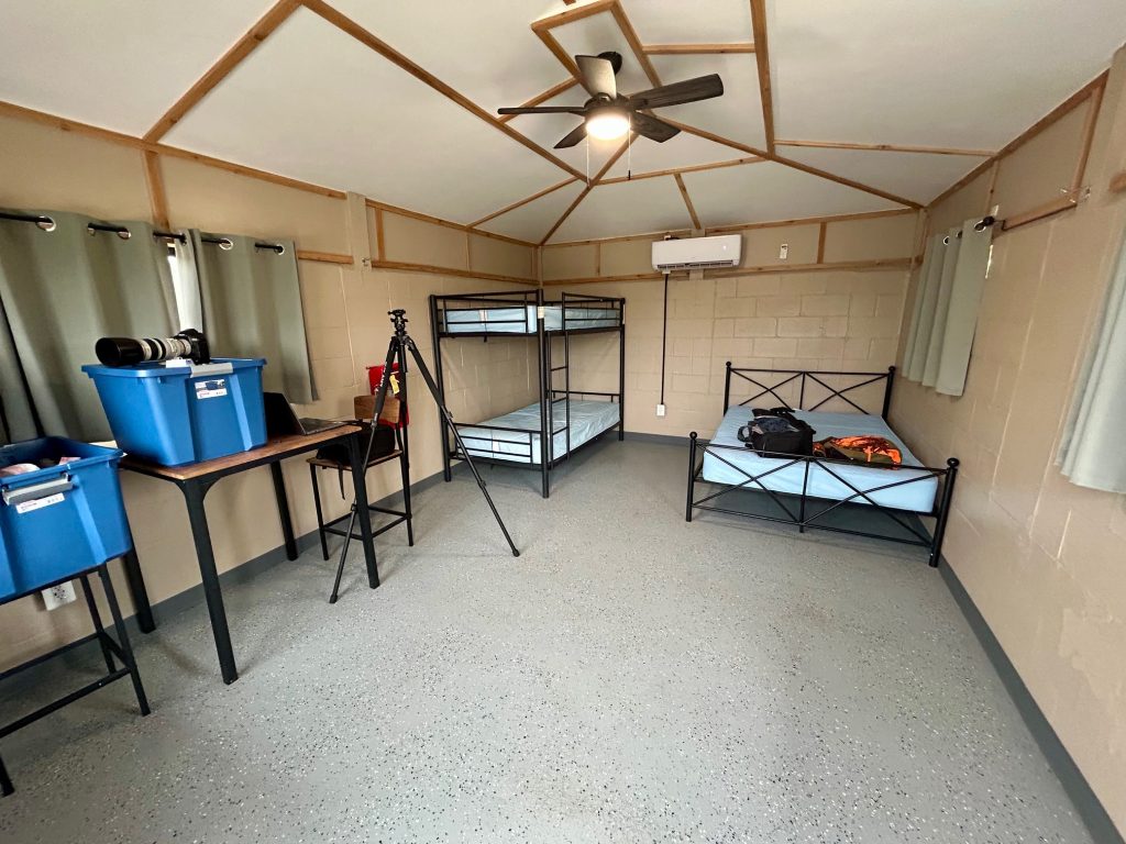
Outside the unit had sufficient parking, a fire ring and a picnic table. I brought fire wood but chose not to build a fire due to the wind in the area at the time. Perhaps it would have been fine, but I chose to go without one.

In the camping area where the cabin was located, only one other visitor vehicle was there. The park was basically empty, so I would say this is a good time to go if you wish to avoid the crowds. The busiest place was the rv full hook up area, but everything thing else was almost empty.
The closest big town in the area is Zapata. I believe it is around 30 miles away. I did encounter a border patrol stop on the way to Hebronville. It was not busy, and I sailed right through.
At daylight on my final morning there, I noticed the sun was trying to make itself known. I quickly grabbed my camera, jumped in the truck and headed out. Nearby was the start of the Desert Trail, the location of my hopeful destination, and it was there that I parked. I hurried down the trail, the crunch of my steps the only sound, and slowly did the sun rise. Soon, the sky began to open and close as the sun fought the dark’s three-day grip on light. And I stood there, shivering as I watched, and silently reveled in the beauty and glory of a brisk South Texas brush-country morning.
If you would like a hi-res digital copy of a photo, or if you have any questions or comments, please contact me at malibu5501@live.com.
Site developer and owner: Roger Ploch
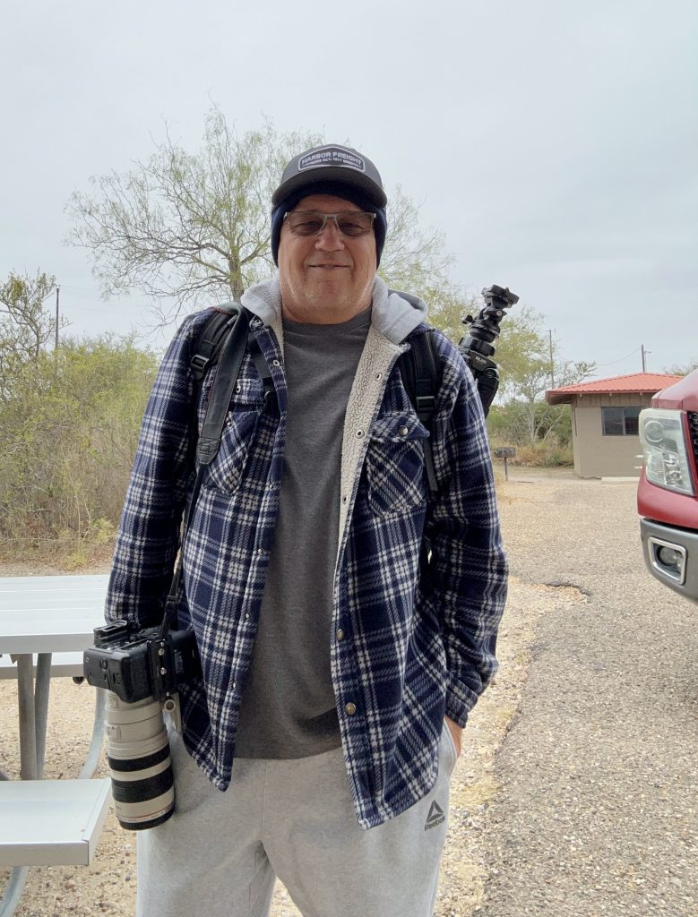
Photographer: Roger Ploch
Copy editors: Savannah Aguilar, Aleena Roy
the hobo traveler
Capturing the State Parks of Texas
Come along as I visit and photograph a different park each month. I’ll share what I learn while there and offer insights into what makes each of them a special part of the Texas landscape.
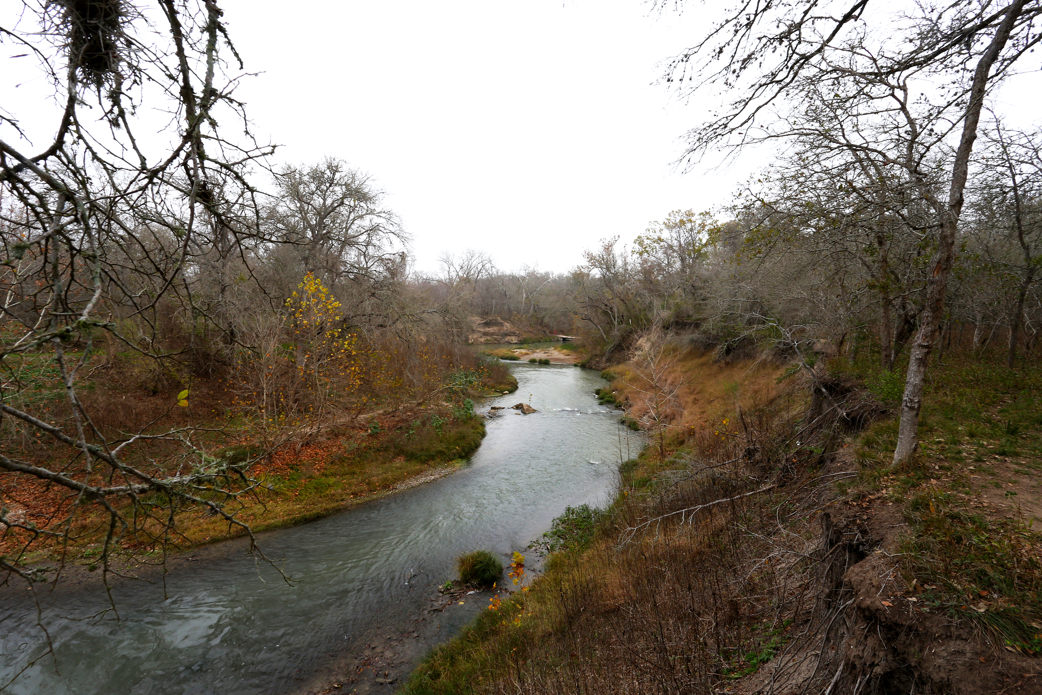
Something I’ve learned about going to the state parks of Texas is that each one has something to offer, something unique that makes it special. Sure, there’s information that points this out in the brochures or online bios, be it a certain plant, landscape or animal, and Palmetto is no exception. It’s even in the name. But, what I’m writing about is something that is just barely tangible, a perhaps purposeful reason why someone chose this spot to represent a part of Texas not often seen or experienced. Did I mention Palmetto has a river?
The Trails
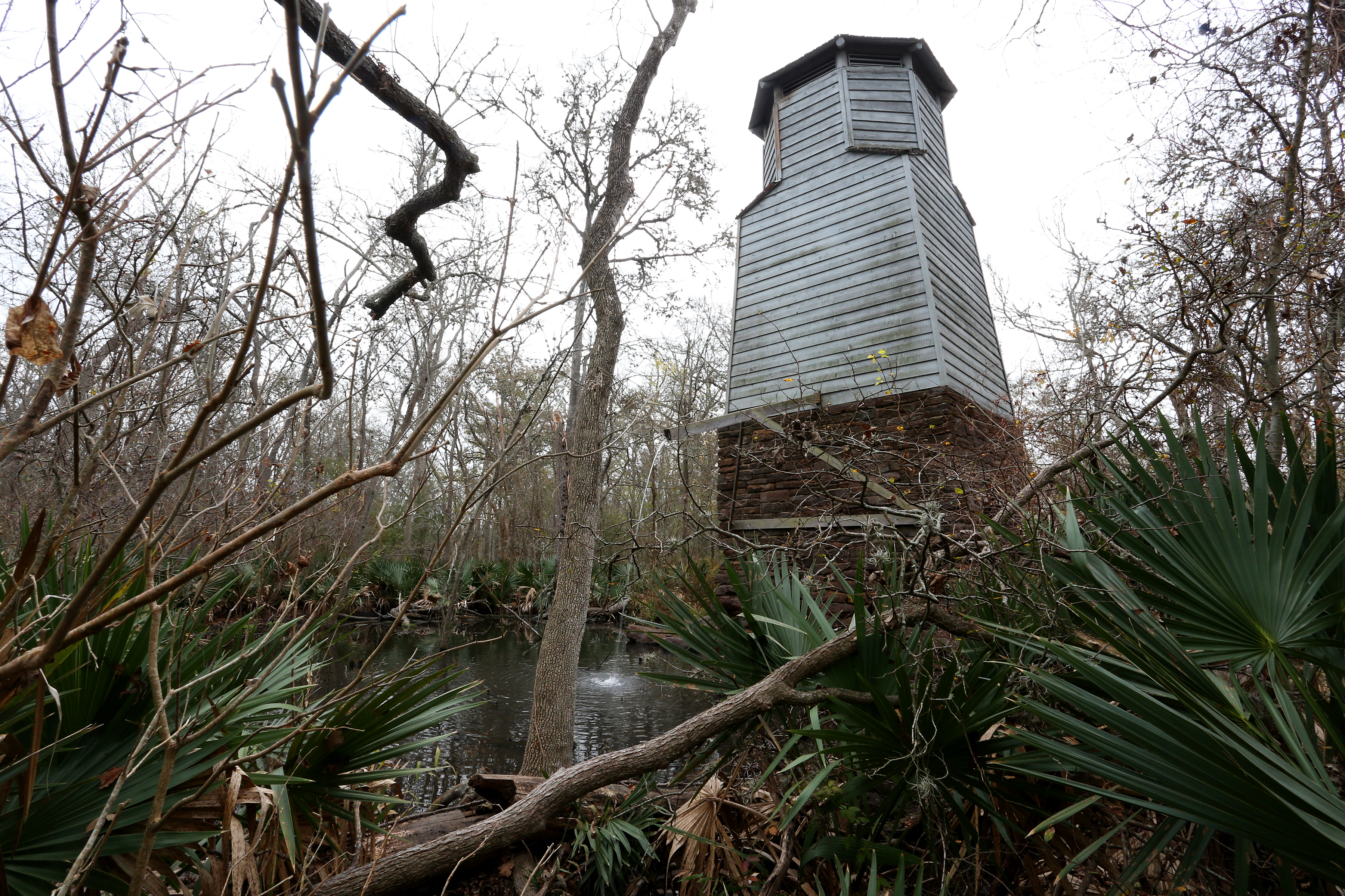
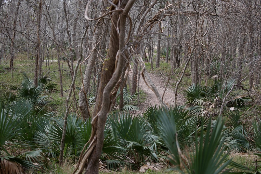
Palmetto State Park offers over five miles of trails, and they include the Ottine Swamp (1 mile), San Marcos River (1.3 mile), Mesquite Flats ( 1.1 mile), and the Oxbow Lake (.7 mile). The trails are flat and easily walked. Bikes are allowed on the trails. Numerous small bridges dot the trails marking spots that sometimes hold water. On my time here, it was mostly dry, but it would be really cool to see it in its swamp state. I spent most of my time on the Ottine Swamp, Mesquite Flats and the San Marcos River trails. There’s also a small interpretive trail located on the Ottine Swamp trail that includes a small pond kept full by a CCC era pump house.


The Wildlife
Unlike Falcon, Wildlife seemed relatively scarce during my stay. The weather and time of year probably played a part, but on my third day there, the birds seemed to become more active and had me chasing and sneaking around on the trails, which was quite fun actually.

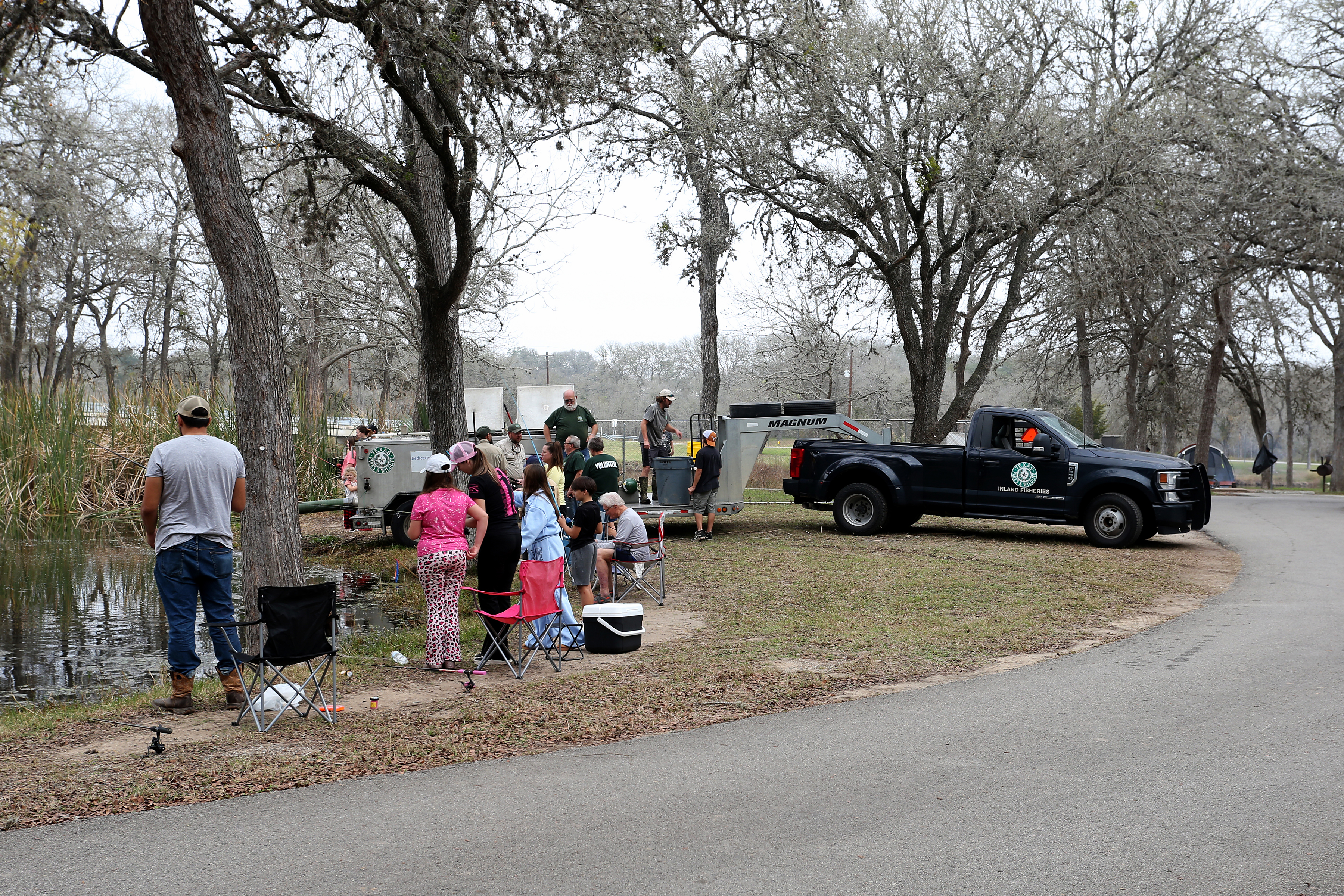
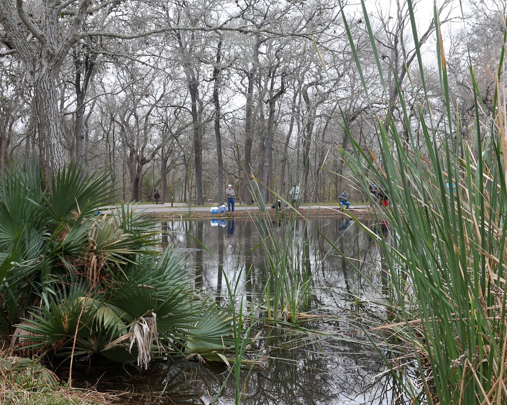
On my final day there, I was able to watch the annual stocking of rainbow trout. Quite a few people attended, fishing gear in hand, and they started catching fish right away. I also met a couple of fellow members from the Texas Fishing Forum who were there for the trout-stocking event. That was a real treat.


The Landscape


My Stay
The park does not offer screened shelters but does have a single cabin located on a high bank by the river. The cabin contains several beds, a microwave, and a wonderful wrap-around porch complete with two rocking chairs. Outside are located a picnic bench, lantern stand, and a fire ring. It’s a cool location that is somewhat removed from the hustle and bustle of the playground and most of the other campers but is still in walking distance of the two restrooms, which are new and somewhat unique in that they are lockable and self contained. Each resembles a restroom at home and includes a shower, sink and toilet.

Right across from the cabin is a small pond and the location of a kayak launch area for the oxbow lake. It is under construction now but should be pretty cool when completed.

I had heard there was some good food to be had in the area, and my buds from TFF mentioned a gotta go to place. On the way out, I stopped at the ranger office, and the guy there said the same thing. So, if you are hungry, head to Luling and stop at Luling Bar B Q for some great food. Oh, and take the left fork in the road.
If you would like a hi-res digital copy of a photo, or if you have any questions or comments, please feel free to contact me at malibu5501@live.com.
Site developer and owner: Roger Ploch
Photographer: Roger Ploch
Copy editors: Savannah Aguilar, Aleena Roy
Copyright © 2025 Roger Ploch